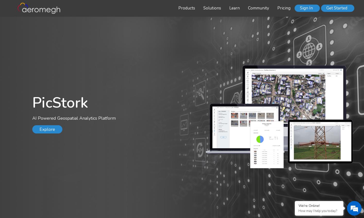
PicStork
About PicStork
PicStork is an innovative AI-powered geospatial analytics platform designed for efficient aerial image analysis. Users can easily upload datasets, train custom models, create workflows, and conduct real-time analysis. It provides a seamless experience for those looking to extract actionable insights from aerial imagery.
PicStork offers flexible subscription plans catering to various user needs. Each tier provides distinct features, including advanced analytics and support. Users can benefit from discounts on annual subscriptions, making it easier to access the platform's powerful tools for aerial image analysis efficiently.
PicStork features a user-friendly interface designed for streamlined navigation and interaction. Its dashboard presents real-time data analysis results, ensuring users can easily access and understand their findings. This layout is tailored to enhance user experience, making aerial image analytics intuitive and engaging.
How PicStork works
Users start by signing up for PicStork and uploading their aerial images. The platform facilitates ML model training using uploaded datasets and allows users to define workflows tailored for their analytics needs. As drones capture images, users can monitor analysis live on the cloud, ensuring efficient operation and instant results.
Key Features for PicStork
End-to-End Aerial Analytics
The end-to-end aerial analytics feature of PicStork allows users to automate the entire process, from image capture to data analysis. This unique capability streamlines aerial data processing, enabling faster insights that empower users to make informed decisions efficiently.
Customizable Workflow Creation
PicStork's customizable workflow creation feature empowers users to define specific tasks tailored to their projects. This functionality enhances data analysis accuracy and efficiency, allowing users to streamline their processes and achieve targeted results, making PicStork indispensable for aerial data analysis.
Real-Time Data Insights
PicStork provides real-time data insights during aerial imaging, enabling users to view and analyze results live as they capture images. This unique feature allows for immediate feedback and helps in making timely decisions while optimizing workflow efficiency for various projects.
You may also like: